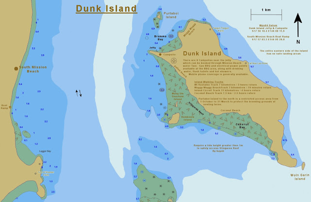
Dunk Island Map
I have modified screen shots of electronic navigational charts to show features relevant to sea kayakers while removing most of the clutter which over complicate standard charts. These modified charts are designed to be scaled up and printed in landscape orientation on A4 size paper.
 Click on the links below to see other related map sections for this area :
Dunk Island
 Click on the links below to see other related map sections for this area :
Comments
Post a Comment