Bay Rock
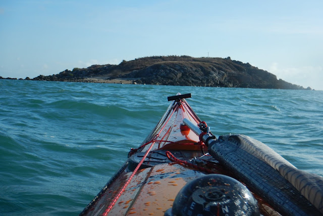
Bay Rock is a small rocky islet off the coast of Magnetic Island in North Queensland. It is approximately 9.3 km from the Palleranda Boat ramp or 17 km from the Strand Beach launch site and has the following GPS coordinates S19.117505 E146.753006 Google Maps Link.
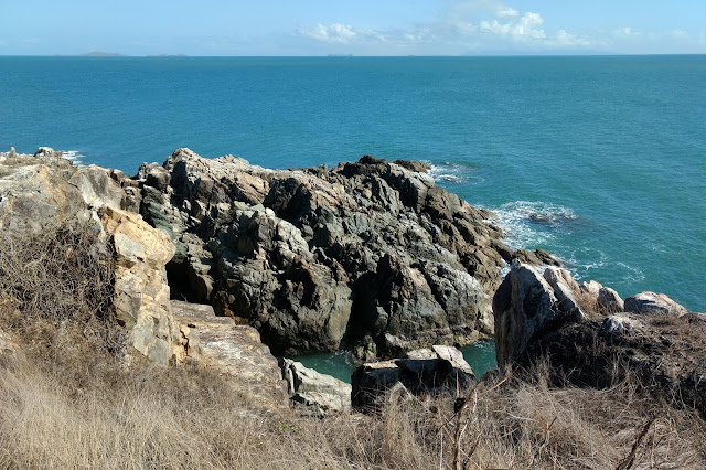
As the name would suggest Bay Rock is a small rocky islet with an approximate circumference of 650 metres and rises steeply to approximately 20 metres above sea level. There is a shallow reef area and a rocky beach on the western side. The rest of the islet is surrounded by deep water and rugged rock faces.
There is a small section of beach which has been cleared of rocks and is suitable for landing a kayak or small boat. However during very low tides, access through the surrounding reef could make landing difficult. The beach consists mainly of broken pieces of coral and due care should be taken when landing or launching in this area.
The islet has a moderately rugged terrain and a distinct lack of shady trees with no source of fresh drinking water. As a result very few people visit the area and it has a very isolated feel about it. There are no established tracks, so if you wish to go to the top you will have to hike through uneven rocky terrain covered by waist high grass and shrubby vegetation.

There are some great views and excellent photo opportunities to be had for those who make their way to the top.
 |
| Former Site of the Bay Rock Lighthouse and Keepers Residence. |
 |
| Looking Southwards Towards Palleranda and Shelly Beach |
 |
| Looking Eastwards Towards Magnetic Island. |
 | |
| Interesting Rock Formations on the Eastern Side. |
 |

There is an automated navigation beacon and a memorial plaque dedicated to the last lighthouse keeper, who was tragically lost at sea while returning to Bay Rock from Townsville.
Trip Planning Considerations
- Rocky beach area consisting of broken coral pieces with a small cleared area for landing.
- Camping possible but not well suited due to rocky ground and lack of shady areas.
- Shallow reef on the leeward side of islet.
- No fresh water source to be found.
- Fishing permitted.
- No Phone Reception.
Bay Rock History
Bay Rock was owned by the government and used solely for lighthouse purposes. Its main use being to assist vessels into the quarantine station at West Point, as well as assisting passage into Cleveland Bay or to a main shipping anchorage off Bay Rock.

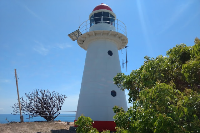
The lighthouse and a small cottage were erected In 1886 and was maintained by a number of successive signal men and there families until 1920 when the last lighthouse keeper was tragically killed at sea. The lighthouse became fully automated in 1930. During the 1980s the lighthouse was deactivated and replaced with a small fiberglass beacon which is still active, displaying a characteristic pattern of two white flashes, every eight seconds. In 1992 the lighthouse was relocated to the Townsville Maritime Museum, where it was restored.
 |
| Bay Rock Light House on Original Sight. |


Comments
Post a Comment