Posts

Cape Cleveland Light House

Image
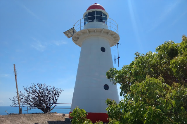
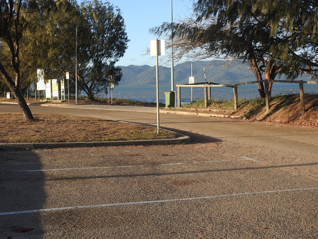
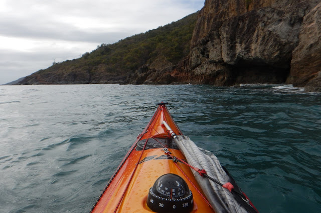
The Cape Cleveland Lighthouse is an active, heritage-listed lighthouse marking the northern point of Cape Cleveland and the hazardous reefs and rocks situated on the approach to Cleveland Bay.  The lighthouse is located approximately 21.2 km from the South Townsville Boat Park or 25.6 km from the Palleranda Boat Ramp and the beach access to the lighthouse has the following GPS coordinates  S19 11 05.8  E147 00 54.4   Google Map Link The lighthouse is located on a northerly facing promontory approximately 53 m above sea level and displays a flashing multi coloured sector light every 7.5 seconds.  The red sector which projects into Bowling Green Bay signifies the hazardous navigational area between Salamander Reef and Four Foot Rock. The Bowling Green Bay side of the promontory has a very rugged and scenic coastline which is great for photographing and exploring in close with a kayak during calm to moderate conditions.  Access to the lighthouse is on the Cleveland Bay side of

Palleranda Boat Ramp

Image
Palleranda boat ramp is located towards the end of Cape Palleranda Road and is an ideal spot for launching a sea kayak.  The GPS coordinates for the boat ramp are S19 11 50.1  E146 46 28.2   Google Maps Link. The Palleranda boat ramp provides easy access to a gently sloping sandy beachfront, which makes for easy and hassle free kayak launches and landings.  It is an ideal launch site for trips to Magnetic Island,  Shelly Beach, Bay Rock, Middle Reef, and exploring the Townsville coastline north of the Strand. The boat ramp has an unusual design, made up of small interlocked concrete blocks with deep wide grooves set  between them.  As there are no raised side walls, sand tends to build up on top of the ramp in a mound just above the high tide level. (Photo courtesy of Gerry Lyn from Townsville Kayak Club ) This sand is not a problem for most vehicles with good ground clearance, but if you are concerned, you could stop your vehicle just before this sand mound

Garmin Etrex 20x GPS

Image
The Garmin Etrex 20x is a lightweight and compact GPS unit designed and constructed to be waterproof to IPX7 standards and holds up to a bit of rough handling.  The unit is powered by two AA batteries, which provide sufficient power for 2 full days of kayaking.  Furthermore this unit has mapping capabilities, is highly customisable and has all the functionality a kayaker could want in a GPS unit. The unit has a 3.5 x 4.4 cm colour display which is clean and crisp and can be backlit to improve visibility.  There are five buttons placed along the vertical edges and a joystick style thumb button mounted on the front face for scrolling, inputting and selecting.  When I was choosing a GPS device for kayaking, I ruled out the touchscreen devices right away as touchscreens don’t work very well when wet and they also have a lower battery life. There are rubberized covers on all of the buttons along with sealable covers for the battery compartment and USB port.  The waterpro

Florence Bay

Image
Florence Bay is an idealic bay located on the eastern side of Magnetic Island approximately 16.35 km from the Strand launch site or 16.5 km from the Palleranda boat ramp, with the following GPS coordinates S19 07 18.6  E146 52 41.6 .  Google Maps Link The bay consists of a long sandy beach surrounded by rocky headlands on either side.  There is an extensive coral reef located on the northern side of the bay, approximately 60m from the beach and extending out to the tip of the northern headland.  This reef is great for snorkeling and as a result the bay is very popular with tourist and tour operators. The crystal clear water gives a great view of the coral below as you pass over it while making your approach to the shallow sandy beach area.  The gentle sloping beach means large sections of beach will be exposed or flooded in a short space of time and you will have to be mindful of where you position your kayak during large to medium tides if you are going to be stayin

Rollingstone Bay

Image
Rollingstone Bay is a rocky section of coastline located on the western side of Magnetic Island between the tip of West Point and Huntingfield Bay.  The bay and the rocky headlands surrounding it extend for approximately 3.5 km.  Google Map Link This is a very scenic section of coast which makes for interesting kayaking especially if cruising in close to the rock formations. This area is reasonably well protected from the prevailing South Easterly winds, but will be fully exposed when the wind blows from the North East. There is a small but steep rocky beach area, located within a small cove  just east of Liver Point.  The beach consists of  medium sized flat rocks but the steepness of the beach has always deterred me from trying to land here.  Landing a kayak here would only be feasible during extremely calm condition. Rugged over hanging rock formations. Looking westwards towards Liver point. Granite boulders Just before Huntingfield Bay. Trip Considerations The wat

Yanks Jetty

Image
Yanks Jetty is the name given to a floating pontoon positioned approximately 2km from the southern tip of Orpheus Island.   This area was the original site of an American WW2 Degaussing (demagnetising) Station for allied ships and submarines, hence the name.  It is located approximately 20.5 km from the Forrest  Beach Boat Ramp and has the following GPS coordinates  S18 39 04.2 E146 29 12.0  Google Maps Link. The pontoon consists of a 18 x 9 metre platform with an attached gangway connecting it to the beach.  There is a centrally shaded area containing several picnic tables and a snorkeling platform with easy access ladders.  The entire structure is moored approximately 55m from the shoreline on the edge of the surrounding reef.   There is a National Parks Camp Site located approximately 200m south of the pontoon where basic facilities such as a composting pit toilet and picnic tables are provided.  There used to be a gas BBQ at the campsite, but the burners and plate have been