Posts

Showing posts with the label Cleavland Bay

Florence Bay

Image
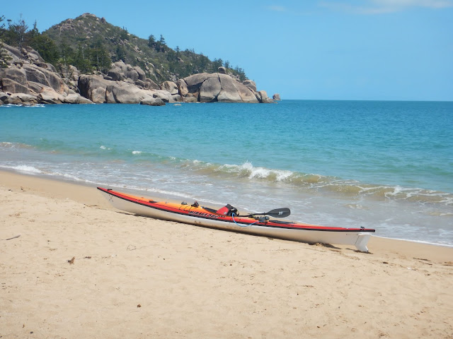
Florence Bay is an idealic bay located on the eastern side of Magnetic Island approximately 16.35 km from the Strand launch site or 16.5 km from the Palleranda boat ramp, with the following GPS coordinates S19 07 18.6  E146 52 41.6 .  Google Maps Link The bay consists of a long sandy beach surrounded by rocky headlands on either side.  There is an extensive coral reef located on the northern side of the bay, approximately 60m from the beach and extending out to the tip of the northern headland.  This reef is great for snorkeling and as a result the bay is very popular with tourist and tour operators. The crystal clear water gives a great view of the coral below as you pass over it while making your approach to the shallow sandy beach area.  The gentle sloping beach means large sections of beach will be exposed or flooded in a short space of time and you will have to be mindful of where you position your kayak during large to medium tides if yo...
Rollingstone Bay

Image
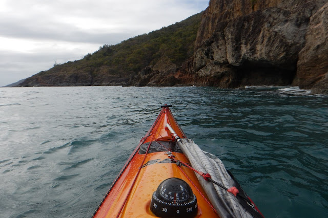
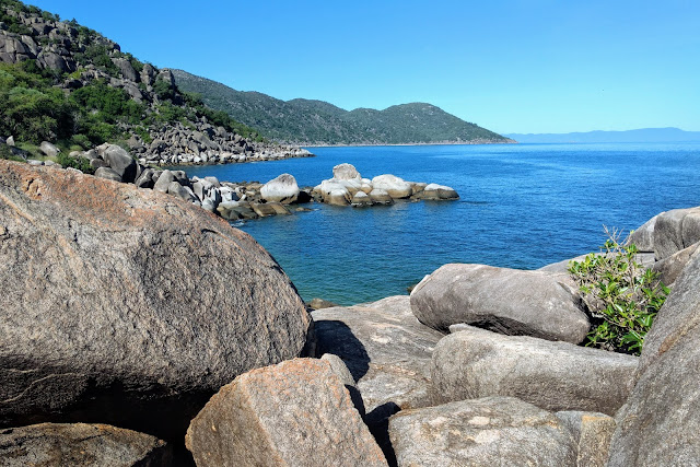
Rollingstone Bay is a rocky section of coastline located on the western side of Magnetic Island between the tip of West Point and Huntingfield Bay.  The bay and the rocky headlands surrounding it extend for approximately 3.5 km.  Google Map Link This is a very scenic section of coast which makes for interesting kayaking especially if cruising in close to the rock formations. This area is reasonably well protected from the prevailing South Easterly winds, but will be fully exposed when the wind blows from the North East. There is a small but steep rocky beach area, located within a small cove  just east of Liver Point.  The beach consists of  medium sized flat rocks but the steepness of the beach has always deterred me from trying to land here.  Landing a kayak here would only be feasible during extremely calm condition. Rugged over hanging rock formations. Looking westwards towards Liver point. Granite boulders Just before Huntingfield Bay. ...

Lovers Bay

Image
Lovers Bay is a small  secluded bay on the northern side of Magnetic Island between Five Beach bay and Horseshoe Bay.  It is located approximately 14.3 km from the Palleranda Boat ramp  and has the following GPS coordinates  S19 06 19.7  E146 49 57.7   Google Maps Link Lovers Bay is only accessible by boat and has a shoreline consisting mostly of large boulders surrounded by trees and undergrowth.  There is a very small sheltered section of beach which is ideally suited for landing a kayak or small boat. The bay is located on the edge of the GBMPA Green Zone, so fishing is not permitted within the bay, but once you round the northern headland you are outside of the Green zone and fishing is allowed.  There is a small stretch of sand and coral rubble above the high tide zone  where a tent could be set up. Climbing over the boulders on the northern headland presents some excellent photo opportunities as well as exposing a contin...

Radical Bay

Image
Radical Bay is a picturesque bay on the northeastern end of Magnetic Island.  It is approximately 19.3 km from the Palleranda Boat ramp or 18.3 km from the strand launch site and has the following GPS coordinates S19 06 46.5  E146 52 28.8  Google Map Link Radical Bay is one of my favorite swimming beaches to visit on Magnetic Island.  It has a 700m wide gentle sloping, smooth sand beach surrounded by crystal clear water.  I usually stop for a break here when circumnavigating the island as it is roughly the half way point.    One of the first things you notice as you first approach this bay are the Coconut and Banyan fig trees which line the beach.  The thought of a quick swim followed by a long break under the abundant shade of the banyan fig trees draws me to this bay time and time again. There is a road and walking tracks which lead into Radical Bay, but no other amenities.  The road is in a poor state of repair, s...

Huntingfield Bay

Image
Huntingfield Bay is one of five secluded Bays which make up the area known as Five Beach Bay.  V ery few people frequent this beautiful area and its beaches, as it requires a bit of effort to get there.  T here are no roads or walking tracks leading into this bay and  is only accessible by boat. Crystal clear water, beautiful scenery and the remoteness all add to it's beauty. Huntingfield Bay is located on the northern side of Magnetic Island approximately 12 km from the Palleranda boat ramp in Townsville.  The land area above the tidal zone forms part of the Magnetic Island National Park, while the tidal and ocean area within the bay are a designated as a no fishing zone by the Great Barrier Reef Marine Park Authority. Long sections of sandy beach in the middle of a well protected bay make for a simple beach landing with a kayak.  However due caution should be applied if choosing to land or explore close to shore, on the eastern side of the ba...

Cockle Bay Wreck

Image
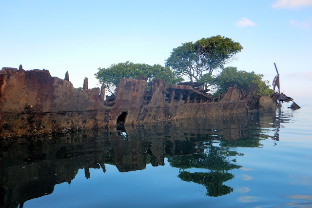
Located  on the south west side of Magnetic Island rests the wreck of the "SS City of Adelaide".  The remains of this once proud ship now forms an artificial island approximately 300 m off  the shoreline of Cockle Bay, with GPS co-ordinates S 19 10 29.5   E 146 49 30.9    Google Maps Link Launching from Palleranda Boat Ramp, the wreck is approximately 6 km away at a bearing of 65 degrees (magnetic) and lies within the tidal zone of Magnetic Island.  Access to it, is best achieve during mid to high tide, as the area will be completely dry at low tide levels below 0.6 m.  Mangrove Trees Growing Inside the Hull of the Wreck. Looking Towards the Mid Section of the Wreck.   Looking Towards the Stern of the Wreck  When viewed from the seaward side this wreck blends in seamlessly with the surrounding mangrove fringed coastline, making it difficult to locate without  a bearing. It's n...

Picnic Bay

Image
Picnic Bay is a small  bay on the south-east corner of Magnetic Island.  It is located approximately 7.03 km from the Palleranda Boat ramp or 8.23 km from the Strand Beach launch site and has the following GPS coordinates  S19 10 49.4  E146 50 16.3   Google Maps Link                Picnic Bay was the original landing site for ferry services from the mainland.  In 2003 the passenger ferries ceased operating at Picnic Bay,  but the heritage listed jetty still remains.  The jetty is in a fairly good state of repair and is a prominent feature within the bay. The jetty is located at the western end of the bay, along side the surf lifesaving club and the stinger net enclosure.  There is a also a single lane boat ramp next to the jetty and a large sandy beach area perfect for landing a kayak. There are small scattered sections of reef  surrounding t...