Cockle Bay Wreck
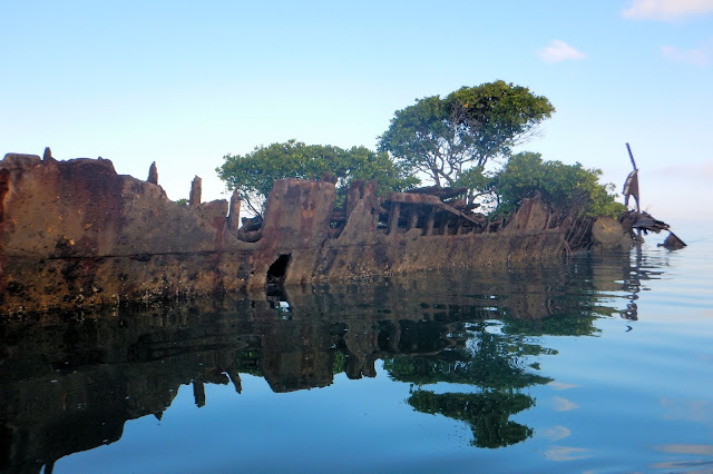
Located on the south west side of Magnetic Island rests the wreck of the "SS City of Adelaide". The remains of this once proud ship now forms an artificial island approximately 300 m off the shoreline of Cockle Bay, with GPS co-ordinates S 19 10 29.5 E 146 49 30.9 Google Maps Link
Launching from Palleranda Boat Ramp, the wreck is approximately 6 km away at a bearing of 65 degrees (magnetic) and lies within the tidal zone of Magnetic Island. Access to it, is best achieve during mid to high tide, as the area will be completely dry at low tide levels below 0.6 m.
 | |
| Mangrove Trees Growing Inside the Hull of the Wreck. |
 | ||||||||||||||||||||||||||||
| Looking Towards the Stern of the Wreck |
History of the Wreck
The SS City of Adelaide was a passenger steam ship, launched in Glasgow, Scotland in 1863. The vessel was later converted into a cargo ship and then used as a hulk for the storage of coal in Townsville. In 1912 the vessel caught fire and burnt for several days.

The hull was stripped, and an attempt was made to float the vessel to Magnetic Island. The vessel was to be scuttled as a breakwater for a Picnic Bay jetty. However, as the vessel was being towed from Townsville, she ran aground in Cockle Bay, where she remains today. The wreck has been further damaged by cyclones and a freak accident where a RAAF aircraft struck the masts of the vessel during a training exercise.
These days the masts have long since been removed, and the outer hull is slowly disintegrating away, while mangrove trees have taken hold in the inner section of the hull. This is a great spot to visit and well worth the detour from the more direct route to Picnic Bay.
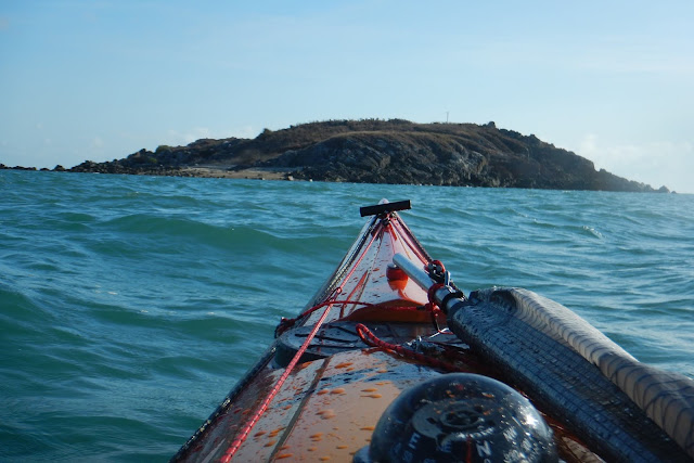
An added benefit of detouring to see the wreck while on route to Picnic Bay, is that not far from the wreck the coastline changes from mangroves to a very scenic boulder lined shoreline, which you are perfectly positioned to follow for the rest of the way to the Picnic Bay.
 |
| About 500 Metres From the Wreck the Mangrove Lined Coastline Changes to Large Granite Boulders Surrounded With Pine Trees. |
 |
| Map Showing the Position of the Wreck. |


Comments
Post a Comment