Posts

Showing posts with the label Rockingham Bay

Hinchinbrook Island Map ( Southern Section )

Image
I have modified screen shots of electronic navigational charts to show features relevant to sea kayakers while removing most of the clutter which over complicate standard charts.  These modified charts are designed to be scaled up  and printed in landscape orientation on A4 size paper.  Hinchinbrook Island  ( Southern Section ) Click on the links below to see other related map sections for this area :  Hinchinbrook Island  ( Northern Section )  

Hinchinbrook Island Map ( Northern Section)

Image
I have modified screen shots of electronic navigational charts to show features relevant to sea kayakers while removing most of the clutter which over complicate standard charts.  These modified charts are designed to be scaled up  and printed in landscape orientation on A4 size paper.  Hinchinbrook Island ( Northern Section ) Click on the links below to see related map sections for this area :  Hinchinbrook Island  ( Southern Section )

Sunken Reef Bay

Image
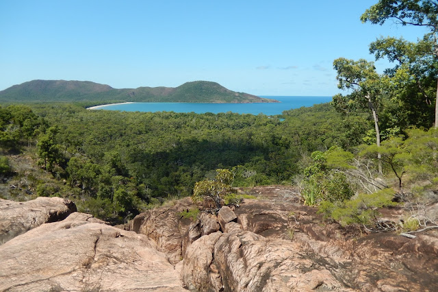
Approach to Sunken Reef Bay and Hillock Point to the far right. Sunken Reef Bay is a sheltered cove located between Mulligan Bay and Hillock point. It has a shallow sandy beach approximately 350 metres long surrounded by rocky headlands.  Easy beach landing at Sunken Reef Bay.  Its sheltered location, easy beach access, and panoramic views make it an ideal rest break before proceeding around the rocky coastline to Hillock Point and beyond. Interesting beach combing along the high tide mark   (photo by Hans Preuss) Currents and trade winds carry an odd assortment of objects across the sea to this beach and makes for some interesting finds when exploring the flotsam and jetsam deposited along the tide line.  A lot of rubbish also gets deposited, so help out the Rangers by placing any rubbish in a pile above the tidal zone or if you’ve got space in your boat, fill a bag and take it out with you. Fressh water Creek at the souther...

Zoe Bay

Image
Zoe Bay located on the eastern side of Hinchinbrook Island is a highly sought after sea kayaking  destination.  The bay consists of a 2.5 km-long curved sandy beach backed with luxurious rainforest and dominated by the backdrop of the craggy peaks of  Mt Bowen.  There are estuaries at each end of the bay separating the beach from the rocky headlands.   The campsites and track to Zoe Falls are on the Southern end of the bay. The beach itself is all sand and is very shallow for a long way out. When landing at Zoe Bay, high tide access is best or you will have a long carry to your campsite.  There are several large  shady campsites with a picnic table and a heavy duty animal proof food storage locker. The wildlife will help themselves to any unattended food items, ( a tent or dry bag sitting on the ground wont stop them).   Zoe bay campsite  (photo by Hans Preuss) The campsites are large shady areas of for...