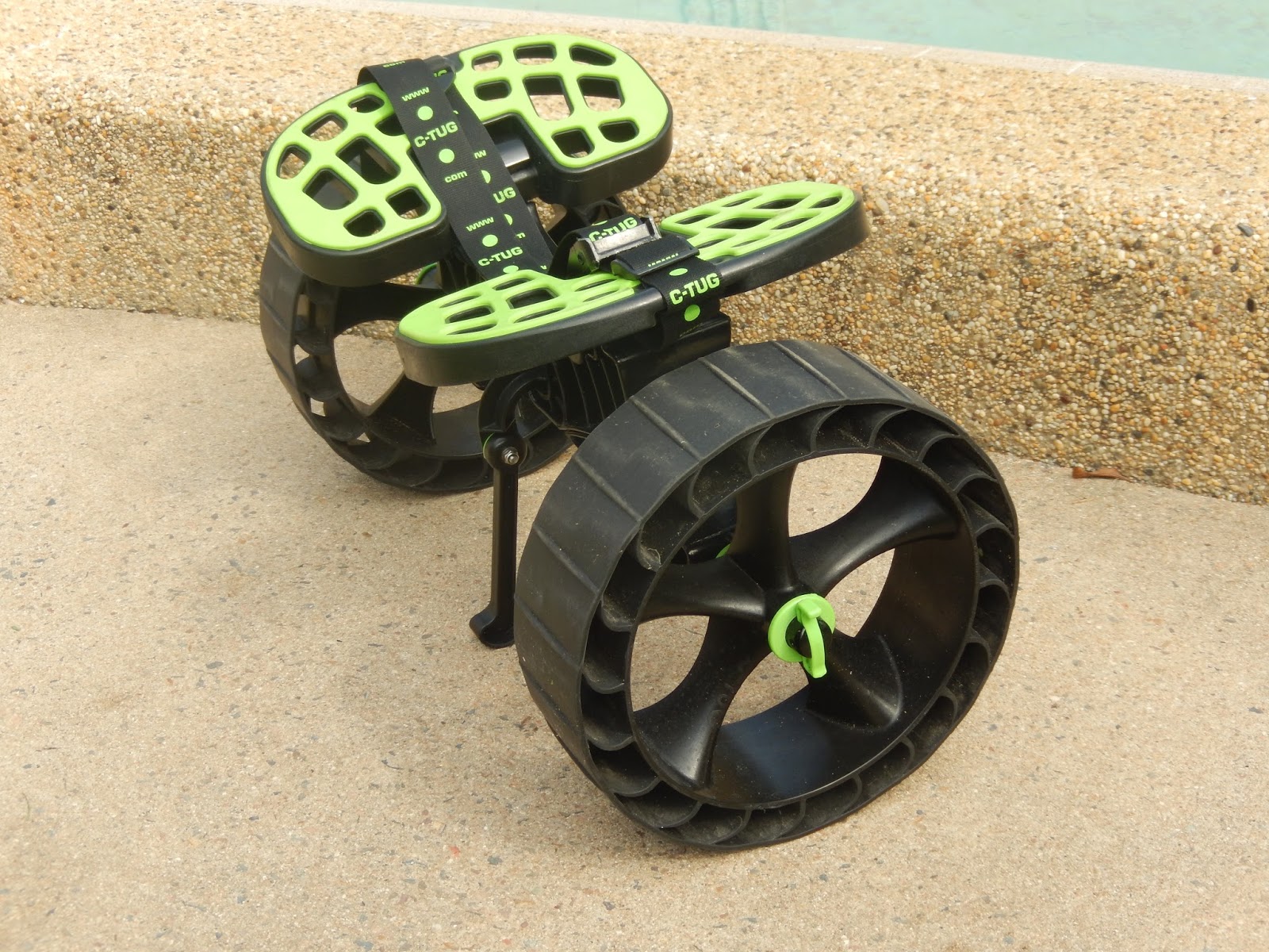
Man created the wheel thousands of years
ago, therefore there is no need to drag a kayak through the sand or haul a kayak over your shoulder for long distances.
Disassembled Position
Wheel clip in open position for
assembly / disassembly
Wheel clip will make an audible click
when locked in place
Fully assembled and ready to use
The
SandTrakz puncture free wheels are designed for use on wet or soft
sand. They mimic the track system used by heavy machinery. The outer
rim
compresses when in use giving a longer track length.
The squishy nature of these wheels also
provide a level of cushioning and flex which makes for an easy
transition from soft sand to other surfaces. They work just as well on
concrete, grass, gravel and dirt paths.
Attaching
the strap to the pad and setting the right adjustment was a fiddly,
complicated procedure, but it only needs to be done once and
instructions are provided. If you are using a narrow kayak, you will
have a lot of extra strap. Rather than cutting the excess strap, I ran
the tail end back through the attachment point and under the pad where
it is out of the way. I then bunched up the loose strap and secured it
with a hair tie as shown in the above picture.
C-TUG
has created a unique kayak trolley that
includes a lot of really cool features in the design. This cart is
clearly built by kayakers for kayakers.
Paying extra for the SandTrakx wheels is definitely worthwhile if you
are going to be launching from sandy beaches. Overall I highly
recommend it to other kayakers based on the following:
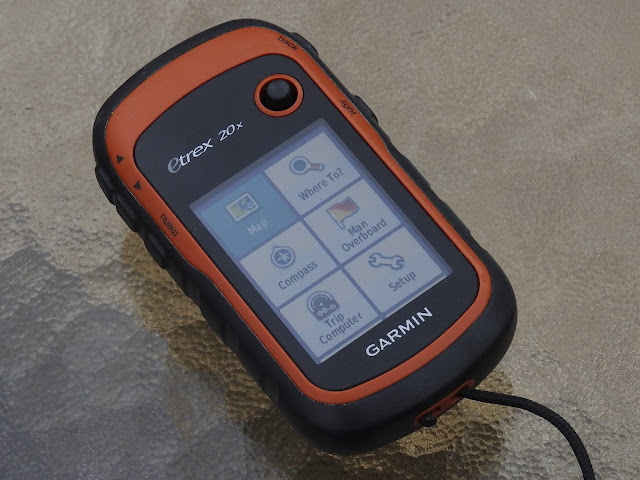
The Garmin Etrex 20x is a lightweight and compact GPS unit designed and constructed to be waterproof to IPX7 standards and holds up to a bit of rough handling. The unit is powered by two AA batteries, which provide sufficient power for 2 full days of kayaking. Furthermore this unit has mapping capabilities, is highly customisable and has all the functionality a kayaker could want in a GPS unit. The unit has a 3.5 x 4.4 cm colour display which is clean and crisp and can be backlit to improve visibility. There are five buttons placed along the vertical edges and a joystick style thumb button mounted on the front face for scrolling, inputting and selecting. When I was choosing a GPS device for kayaking, I ruled out the touchscreen devices right away as touchscreens don’t work very well when wet and they also have a lower battery life. There are rubberized covers on all of the buttons along with sealable covers for the battery compartment and USB ...
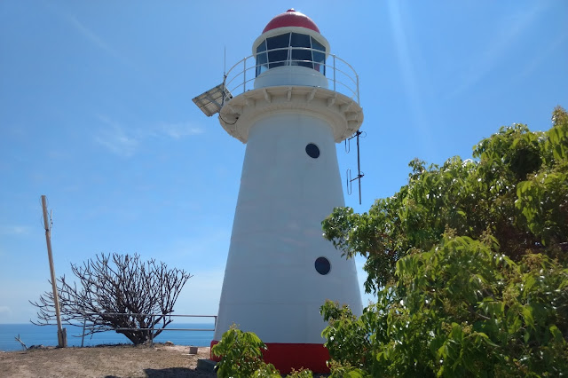
The Cape Cleveland Lighthouse is an active, heritage-listed lighthouse marking the northern point of Cape Cleveland and the hazardous reefs and rocks situated on the approach to Cleveland Bay. The lighthouse is located approximately 21.2 km from the South Townsville Boat Park or 25.6 km from the Palleranda Boat Ramp and the beach access to the lighthouse has the following GPS coordinates S19 11 05.8 E147 00 54.4 Google Map Link The lighthouse is located on a northerly facing promontory approximately 53 m above sea level and displays a flashing multi coloured sector light every 7.5 seconds. The red sector which projects into Bowling Green Bay signifies the hazardous navigational area between Salamander Reef and Four Foot Rock. The Bowling Green Bay side of the promontory has a very rugged and scenic coastline which is great for photographing and exploring in close with a kayak during calm to moderate conditions. Access to the lighthouse is ...
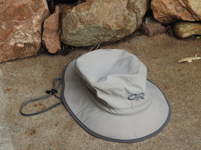
The "Outdoor Research Sun Bucket Hat" is an incredibly comfortable, well constructed and feature packed design incorporating many design features which make it ideally suited for sea kayaking. The hat is lightweight and so comfortable you hardly notice you have it on . It is made from a synthetic double weave ripstop material which provides SPF 50+ sun protection. The brim is angled downwards and has a thin layer of foam sewn into it to help stiffen it, as well as providing buoyancy to keep it afloat should it fall into the water. The under side of the brim has a dark shaded fabric which absorbs glare reflected off of the oceans surface rather then reflecting it back towards your face. There is a head band located along the rim that fits softly against your head to wick away sweat as well as an elastic adjustment cord inside the rim that can be adjusted for the perfect fit or tightened to keep the hat on your head should the wind pick up. A ...


Comments
Post a Comment